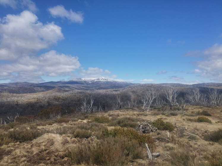
Jagungal, or the “Big Bogong”, stands alone in the northern part of Kosciuszko National Park. As the remotest and northernmost 2000m point, it’s a sought-after peak to bag. Usually it’s climbed in summer as a bushwalk, or in winter as part of a long ski tour on nordic cross-country gear. The closest convenient access in winter is Guthega, from where the approach is something like 30km.
In October, the Khanchoban-Cabramurra road opens up, and from the Round Mountain trailhead, the approach is reduced to a tantalizing 15km…but at this point the snow is gone. Or is it?
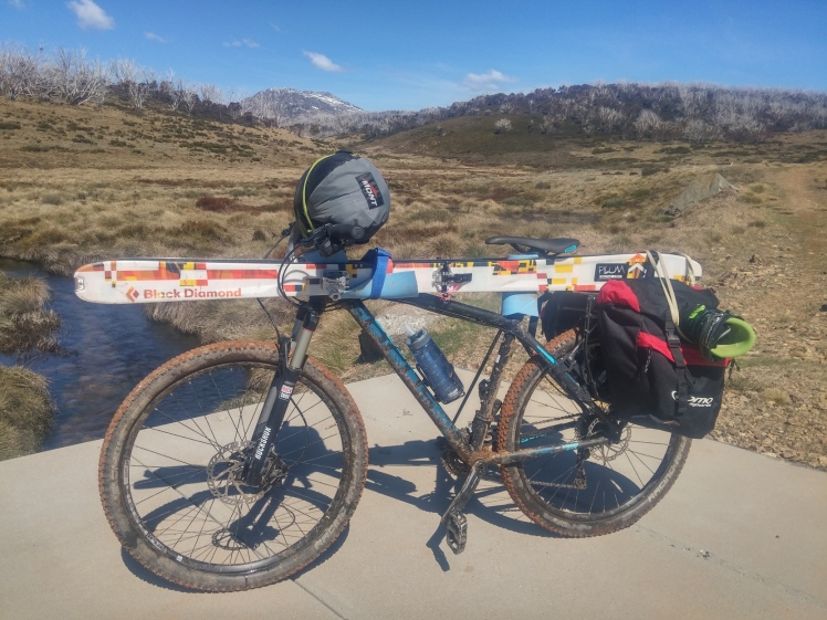
In 2011, the indomitable Darren M did a Jagungal “milk run” , riding in from Round Mountain on his Giant Reign with his skis on a backpack (!) to climb and ski the peak in a day (!!). Now that I own a mountain bike, my head was spinning with the thought of never having to do a fire-trail bash on foot again, and I was determined to ski Jagungal in the same way.
The first obstacle was touring gear. My Focus cross-country bike has no mounting points for a rack – to the disbelief of my bike-touring friends. I’m extremely thankful to “telecrag” from the ski.com.au forums, who was able to lend me a Thule pack-and-pedal rack that cinches with ratchet straps onto any seatstay. I also spent an afternoon experimenting on how to strap the skis to the bike – this wasn’t trivial, and I didn’t really nail it until the 5th or 6th attempt on the last day! I’ll do a more detailed post on this soon for future reference.
With the car loaded up (my bike is NOT worth more than my car, but I reckon bike + AT skis + AT boots must get close) I drove down on wednesday night, and stopped in at telecrag’s place in Canberra to get the bike set up. Then I pushed on to sleep in Cooma.
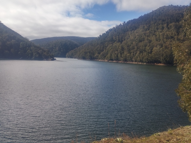
On Thursday morning, I set off on the scenic drive to the trailhead. It’s a solid two-hour drive from Cooma to Round Mountain, and I took it easy, taking in all the attractions from the Snowy Mountains Highway, to the Kiandra Goldfields, to Cabramurra (Australia’s highest town) and the Tumut Pond dam.
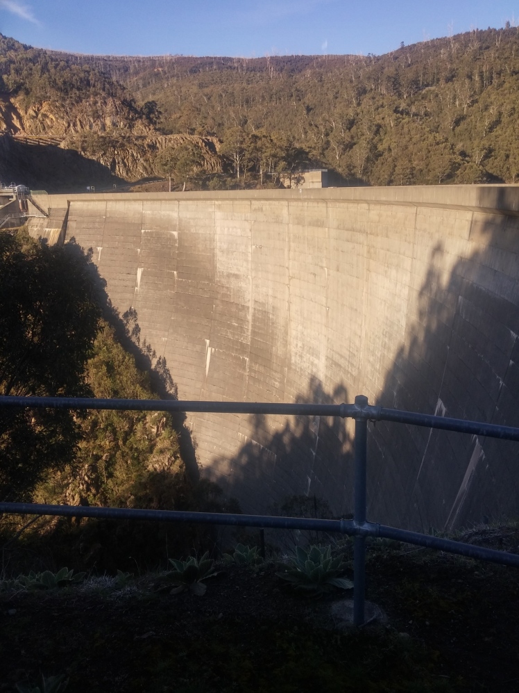
I had thought about starting from the closed road at Cabramurra in September…and after driving from the town, down one side of the Tumut gorge to the dam, and up the other, I was really glad I hadn’t! That would be a hell of a ride.
At the trailhead, I spent quite a long time packing and rigging, and chatting to a bloke who had stopped in on a drive from Victoria through to Canberra. Finally, I started up the Round Mountain trail about 11am, with Jagungal looking wintery and white in the distance. It had rained the night before, and a dusting of snow had clearly fallen up high.
Only a few meters along, and I realized there was a horrible creak with every pedal, as the improperly-tightened rack slowly crept down the seatstays under load. I pulled out the tools and spent another half an hour trying to tighten it up. Fortunately, it seems like we’d just forgotten to tighten one ratchet the night before, and after re-positioning and tightening, the rack didn’t give me any more trouble (the skis were another matter).
Dreams of an easy, flat dirt road where quickly smashed, as I rattled down a very steep rutted hill to a ford and corrugated-iron bridge across a tributary of the Tumut (Round Mountain Creek?). Then it was straight to pushing up the other side, through running rivulets fed by last night’s rain. Then it was along the Toolong range, which although having some mud and obstacles, and being more undulating than I’d hoped, seemed OK.
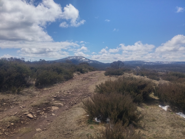
I had a lunch break just before the trail again descended steeply, before climbing up a hill on the other side, I think at the 1596 point.
Then the suck started. As the trail came off the ridge and towards the boggy plains around Hellhole and Pugilistic creeks, the mud reached Tasmanian levels. I became intimate with the red clay-like mud, the black sucking mud, and the areas of straight-up grassy swamp complete with croaking frogs – these sections cleaned the tyres at least. Water started to overtop my boots (I was walking most of this), the tyres were clogged, and it was just generally hard work.
Well, I told myself, to be successful, you have to do stuff that other people are not prepared to do.
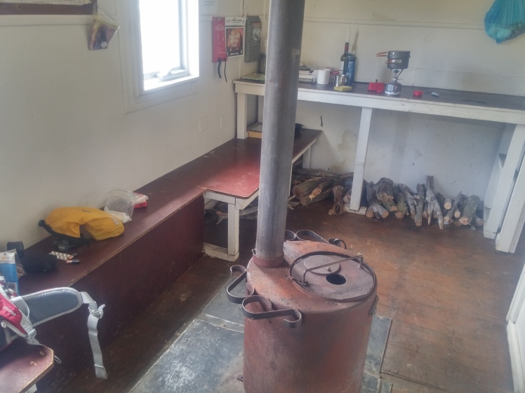
Finally, after a soul-destroying period of hoping the hut would be just over the next hill, before finding only another bog and creek and further hill, I reached Dershkos hut. It’s a great hut and I was very comfortable in it.
After a feed, I went for a short walk, up the hill behind the hut and out on to the swampy plain that is the headwaters of the Tumut and Tooma rivers.
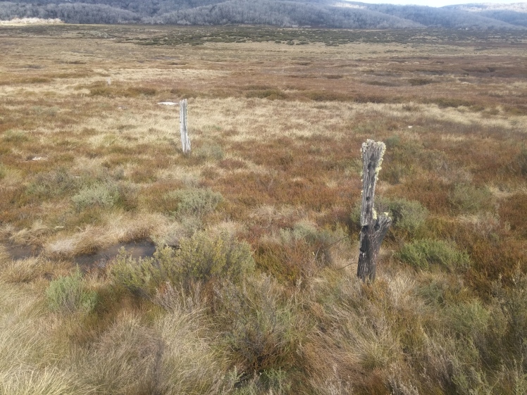
There were remnants of old stock fencelines in the area.
I was left with more daylight than I knew what to do with, it being so far into spring! After a nice dinner, and reading the magazines left in the hut, and a book of Banjo Patterson poems I had on my phone, it was time for bed. Unfortunately, the moon was close to full, so I didn’t try stargazing. In the morning, there was a very heavy frost.
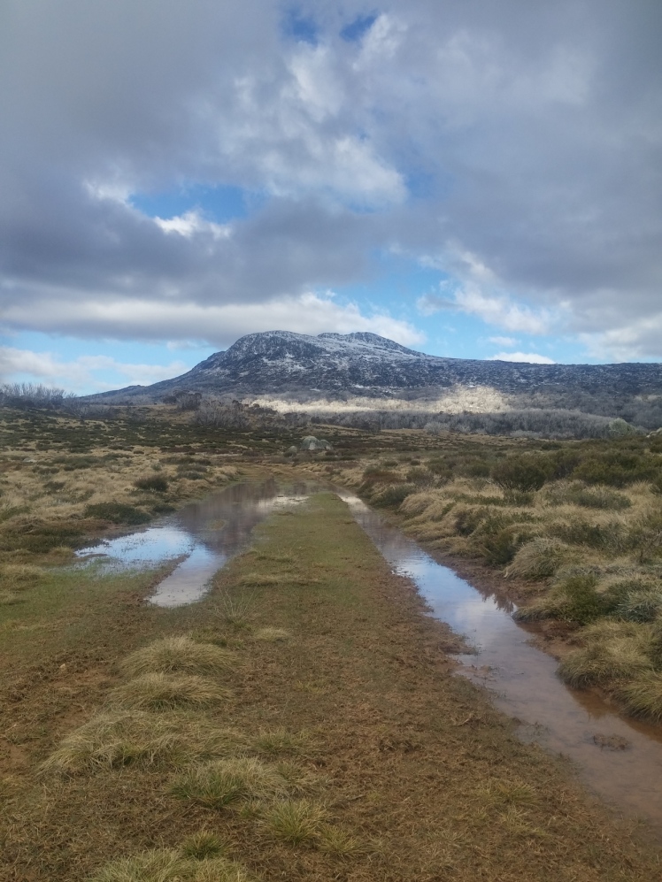
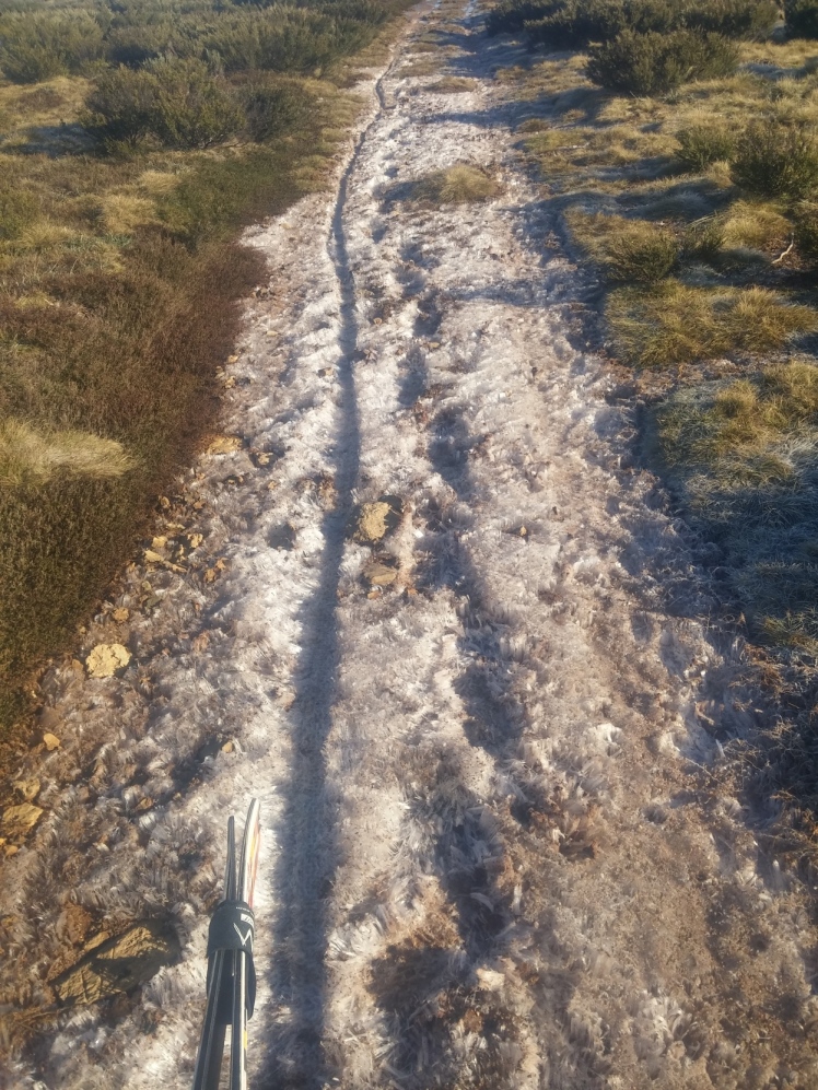
Now, I was hoping that the mud would have, like, frozen, and be easy to travel over (It’s a dire bikepacking trip when you hope the mud has frozen. Literally ‘Grand Armee retreating from Moscow’ stuff), but what happened, was that the cold drew huge fingers of frost out of the mud, with small dots of soil or pebbles on top, forming a fascinating surface that managed to be icy, muddy, and rocky all at once.
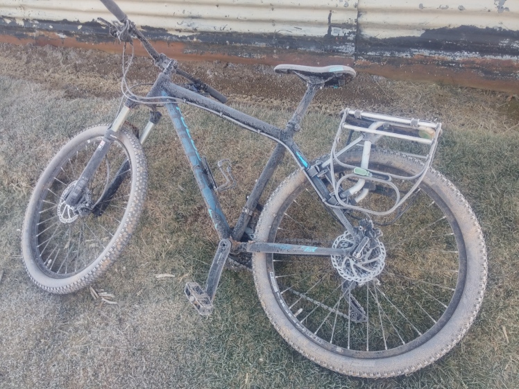
It was, of course, impossible to ride on, and I pushed my bike all the way across the plain to the Tumut river crossing, where I abandoned it with just a little relish.
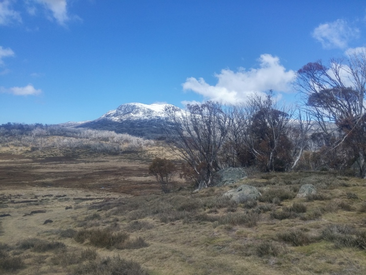
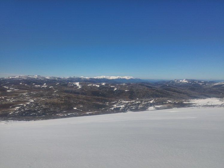
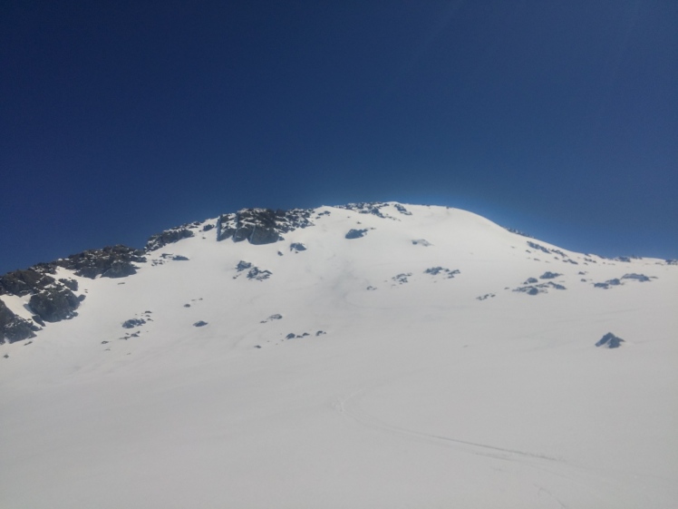
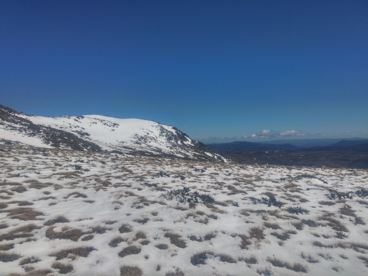
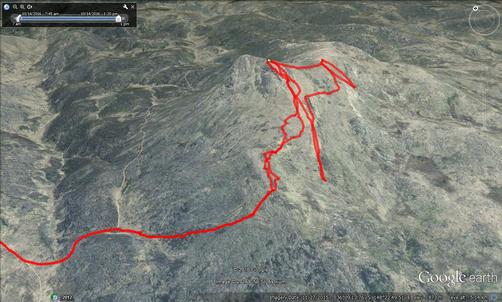
Finally it was time to switch to normal spring skiing mode. The route to Jagungal from the fire trail goes up a very bushy spur next to the source of the Tumut river. I hadn’t spent years following canyoning footpads in the blue mountains for nothing, and managed to follow my feet under the scrub and keep to the overgrown track the whole way. It was better than the mud. Finally, I climbed up a short rocky scramble and got to the marker cairn on the top of the ridge. Shortly after, I hit snow. It was supportable, in fact really well frozen. Thank f%#k, the skiing was actually going to be good after all that.
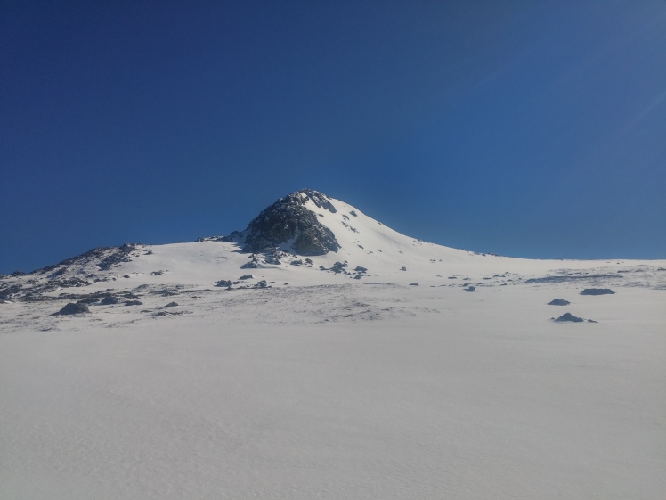
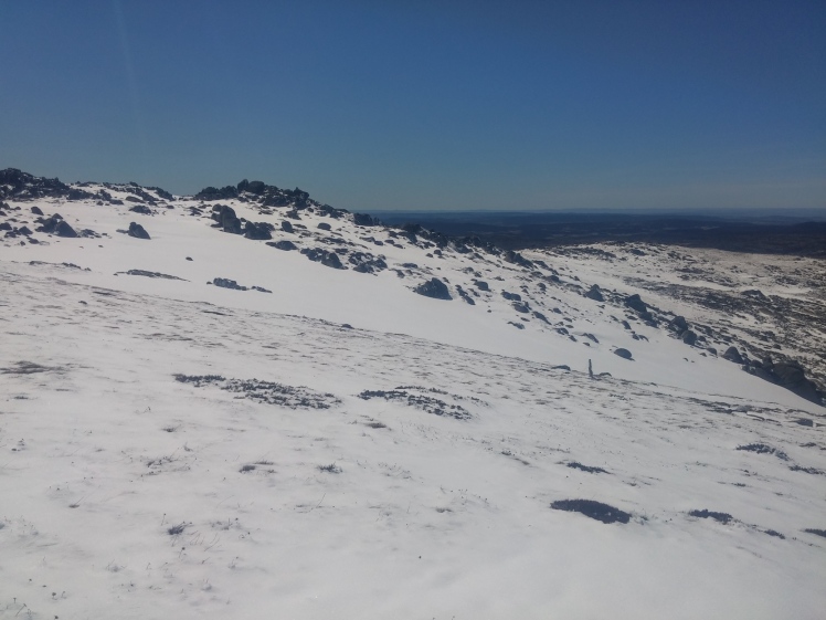
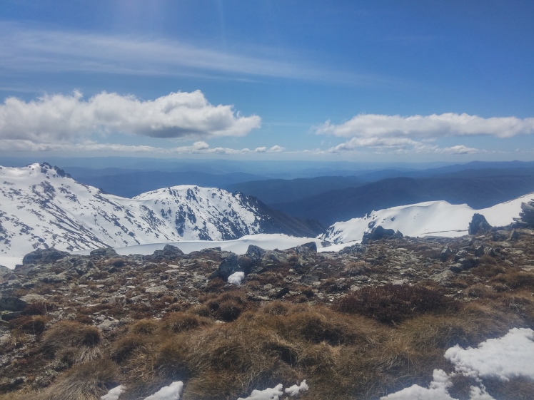
As you can see from the photo, after the exceptionally heavy October snows we’ve had this year, the cover was significantly better than Darren’s 2011 trip. A sea of perfect corn passed under my skins as I gunned for the top, eager to shred the king line off the summit cone before it got too soft.
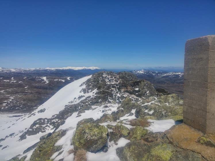
Sweet, sweet victory. A lovely moment as I savored the views on top. I didn’t waste any time to get skiing though, the corn was a-cookin’.
I nailed the steepest, best line off of the main drift just south of the summit, before sailing down a run of perfect corn.
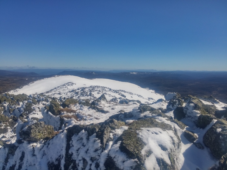
With the big line in the bag, I had a break to eat and drink at the end of the main drift. Then I set off to explore the eastern bowl at the head of the Geehi river.
The corn was incredible. If you’ve watched the TV show “Community”, you might remember the joke about the guild of air conditioner repairmen having a secret room, held at the orgasmically perfect air temperature, where you “can’t tell where your skin ends and the air begins!”. The snow was like that. Like skiing a cloud, I couldn’t tell where my skis ended and the snow began. Turning was but a thought, and I finished the runs on such a high, laughing and cackling.
I managed 3 runs, with a total vert on skis of almost 600m. Not big, but not trivial either.
 It was starting to get hot. After a final linger on the summit, I packed up and set off. Crashing back down through the brush on the descent was fast. And – oh joy – the trails were drying up.
I actually ran in to a couple of bushwalkers on the plain below Jagungal. Hilariously, we barely said hello to each other. Perhaps some slight denial – what, people in my wilderness!? I had a short recovery lounge back at the hut, before packing up and setting off.
The trip back was almost an hour faster in real time. There was still mud and I walked many hills, but overall it finally felt like the bike was a benefit and not a hindrance. The final hill up to the Round Mountain saddle was brutal, and I felt a muscle twinge or two. Luckily, the carpark was right there and I zoomed down the final hill to conclude a successful adventure.
The trip was not quite over – after a pub dinner in Cooma, I made it to Jindabyne to visit Ro. The next day we did a great tour out to Little Austria and Kunama cirque, from the finally-open Charlotte Pass road. It took a while, but we finally got the epic spring skiing that we expect from Kosciuszko.
 Well, what next? This might have got me a little psyched on the full Kiandra to Kosciuszko. I’m keen to try it by bike this summer, and next winter, well, might be time to track down some skate skis…
